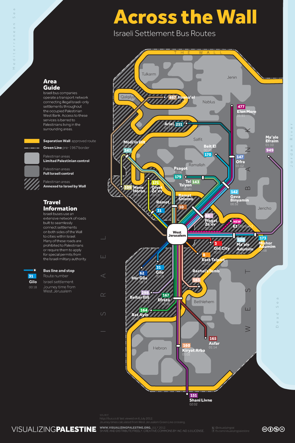
 At Territorial Masquerades, Teo Ballvé discusses this remarkable graphic of bus routes between West Jerusalem and Israeli West Bank settlements. I took the bus from Kiryat Arba on the outskirts of Hebron back to Jerusalem quite late one evening to the surprised looks of the driver and passengers.
This is one of several produced by Visualizing Palestine – Teo links to a few more in his post, but there are several that are worth a look. While many have political messages that are important, I was most struck by the cartography of the bus routes, and this second one on the typologies of roads within Israel, Gaza and the West Bank.  It’s intended to demonstrate the way that different licence plates lead to different access rights, but it links to some of the work done by Eyal Weizman and others around the control of space in the West Bank, which is directly relevant to my interests in the politics of volume.
Clicking on either image will take you to a much larger file.
Discover more from Progressive Geographies
Subscribe to get the latest posts sent to your email.


Pingback: Paletleme Amirliği – Şubat 2013 « Emrah Göker'in İstifhanesi