
To accompany my article The Geopolitics of Boko Haram and Nigeria’s ‘War on Terror’ in The Geographical Journal, I have a short piece at the Geography Directions blog.
By Stuart Elden, University of Warwick and Monash University
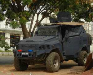 Military Presence in Maitama, Abuja (image credit: Stuart Elden)
The Sunni Islamic group known as ‘Boko Haram’, active in the northeast of the country since at least 2007, came to much wider Western attention in April 2014 with the kidnapping of the school girls at Chibok in Borno state. It then somewhat slipped off the radar with events in Ukraine and the rise of the so-called ‘Islamic State’ in Syria and Iraq. The ‘Islamic State’ was formerly known as al-Qaeda in Iraq, and then as the Islamic State of Iraq and al-Sham. Al-Sham is frequently translated as either the ‘Levant’ or Syria, but part of the point is to encompass a much wider geographical area, and the group has been explicit about its aim of dissolving colonial-era boundaries between states. Foremost among these is the much-hated ‘Sykes-Picot line’ between Iraq and…
View original post 780 more words
Discover more from Progressive Geographies
Subscribe to get the latest posts sent to your email.


