
Some stunning photos of the NSA from Trevor Paglen.
Understanding Empire: Technology, Power, Politics
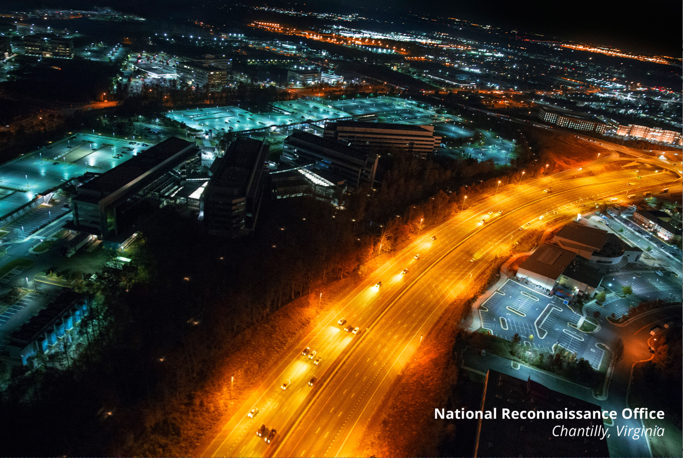
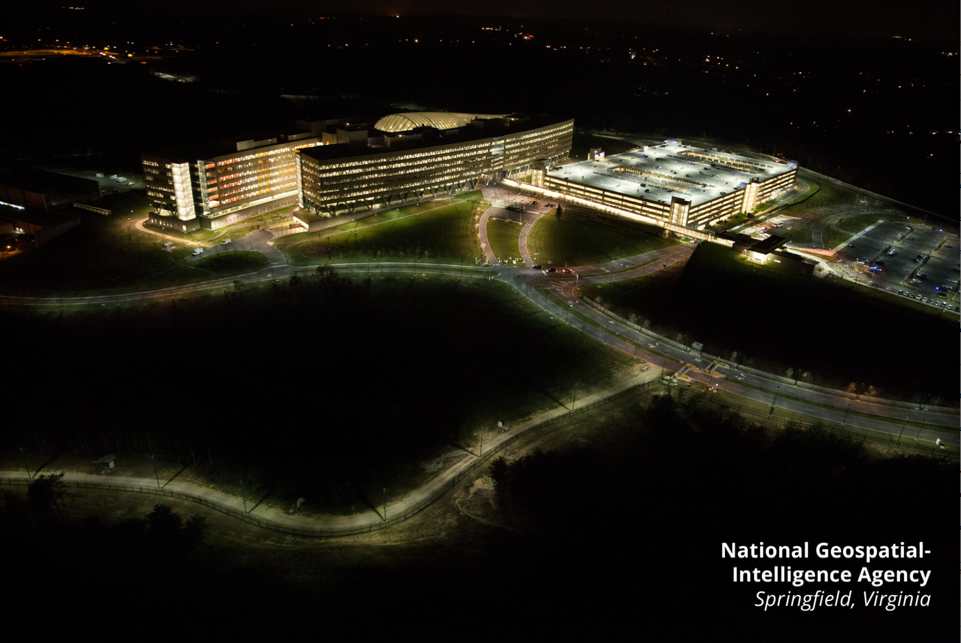
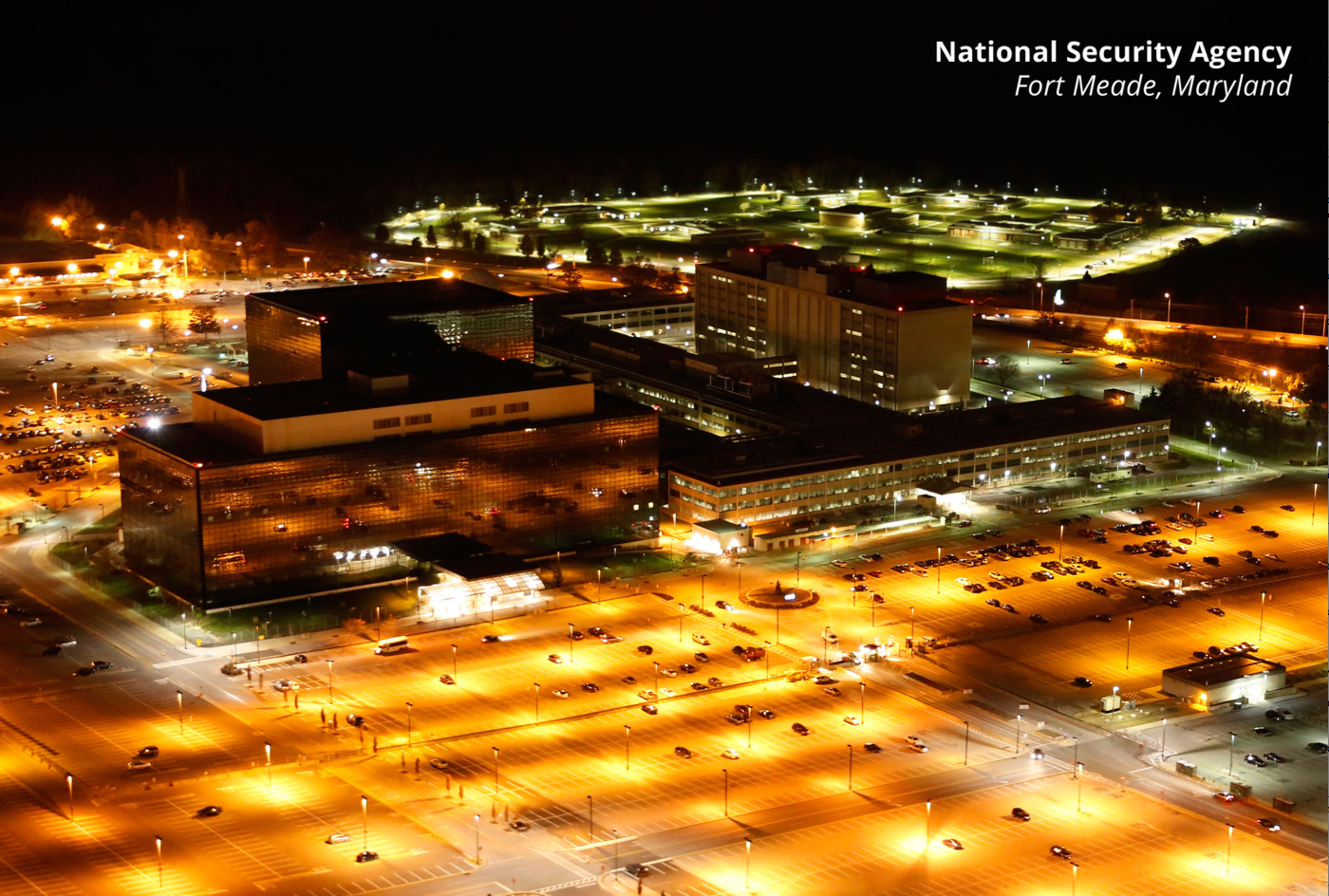
Traver Paglen has released these birds-eye photos of the NSA (National Security Agency, the “signals” intelligence organization, $10.8 billion dollar budget), the NRO (National Reconnaissance Office – in control of U.S. satellites, $10.3 billion dollar budget), and the NGA (National Geospatial-Intelligence Agency – the mapping [GIS] agency, $4.9 billion dollar budget). As Paglen notes, much of the discussion of the U.S.’ surveillance state lacks a physical, or spatial component. These nightime images, taken from a helicopter, are reminders of the enormous footprint that collecting planetary-wide data actually makes in the ground. Here’s the images, which can be freely distributed.
Discover more from Progressive Geographies
Subscribe to get the latest posts sent to your email.


