
Since the UN vote on giving Palestine non-member observer status, Israel has retaliated in a range of ways. One of them is through suggesting that the moratorium on settlement building in the area known as E1, or East 1, is no longer binding. The Jerusalem Post has a story on this; as does Al-Monitor.
E1 is a large space in the West Bank between Jerusalem and the Israeli settlement of Ma’ale Adumim, and is itself intended to be a new settlement. If completed it would almost completely separate the West Bank into a northern and southern section, largely cut off from each other. It would entirely isolate Arab East Jerusalem. The New York Times has a helpful map; report and a 2011 video of maps here.
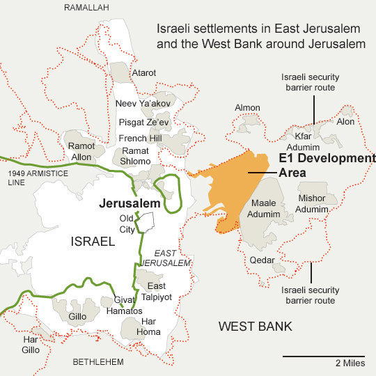
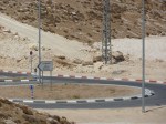
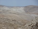
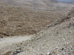
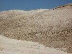
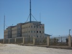
The area is ready to go if given the green light, but the Obama administration, and previous US administrations, are set against. I visited E1 in the company of the NGO Bimkom in 2009. At the moment there is extensive infrastructure there, including roads, roundabouts, street lights, road signs, powerlines and presumably irrigation and sewage tunnels—things on the surface, above it, and below it. But as yet there are no buildings, with one exception, the police station on top of the hill, the Samaria and Judea Police District Headquarters, said to be the biggest in the West Bank.

Six further pictures taken by me in 2009 are available through the thumbnails below

A joint B’Tselem/Bimkom report on the expansion of Ma’ale Adumim is available here, with some discussion and videos (including the one below).
Juan Cole has an excellent analysis on the wider picture (along with a few comments on E1) at TruthDig; his Informed Comment site remains essential reading on the wider region. What many of the news reports on E1 omit or forget is that Ma’ale Adumim is itself an illegal settlement built on occupied land, and that Israel’s annexation of East Jerusalem is itself not generally recognised as legitimate.
This interactive map from the US S. Daniel Abraham Center for Middle East Peace is extremely well done and revealing for what it shows – an ability to imagine the cartography and see the population included if certain settlements are incorporated into Israel. It doesn’t feature E1, and doesn’t allow the interactive user to add some of the more distant Israeli settlements. Adding Ma’ale Adumin creates an exclave of Israel with a narrow access route, presumably to be surrounded by the wall/barrier. But the map doesn’t allow for equivalent land swaps from the other side, from Israel to a new Palestinian state. Even if the 1967 lines (the armistice lines from the 1948-49 war, or the so-called ‘Green line’) form the basis for the settlement, most proposals have suggested some deviation on both sides. Indeed the interactive map allows you to see three such proposals – an Israeli one from 2008; a Palestinian one from 2009, and the Geneva Initiative of 2003. But it doesn’t allow you to imagine alternatives, or even to return land gained by Israel in the war of 1948-49 beyond that allocated by the 1947 UN partition plan. Israel’s settlement policy and the building of the wall/barrier has long been to create ‘facts on the ground’ that will be discussed if the two-state solution ever gets put in place. Or, to some, to prevent that ever being the case. Area E1 is a key example of that policy, even if the current discussions may be to create a position it can easily retreat from, precisely in order to seem like it is still serious about the peace process.
Discover more from Progressive Geographies
Subscribe to get the latest posts sent to your email.


Pingback: Area E1 in the West Bank | Progressive Geographies « PHILOSOPHY IN A TIME OF ERROR
Pingback: Resistance in Area E1 | Progressive Geographies
Pingback: A week at Al Quds Bard Honors College | Progressive Geographies